Morayshire Combination, Morayshire (Elgin)
Morayshire Combination comprised the 18 parishes of Aberlour, Alves, Bellie, Birnie, Boharm, Dallas, Drainie, Duffus, Elgin, Forres, Kinloss, Knockando, New Spynie, Rafford, Rothes, St Andres-Lhanbride, Speymouth and Urquhart. They were later joined by Botriphnie. The total population of the member parishes in 1881 was 41,285.
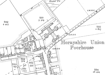
The Morayshire Combination poorhouse was built in 1863-4 at Bishopmill to the north of Elgin. The architects were Alexander and William Reid. The site location and layout are shown on the 1905 map below.

Morayshire site, 1905
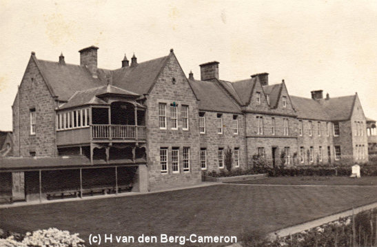
A single-storey entrance block stood at the south of the site. This probably contained the porter's quarters, a committee room, and possibly an office for the relieving officer. A walled path led to the main building which had the H-shaped layout found in many poorhouse. The larger block at the front was a corridor plan building with a central portion which would have contained the Master's quarters. The poorhouse dining-hall and chapel were located in the central range at the rear. The two wings of the front block contained male and female accommodation, probably with the aged at the front side and able-bodied or "dissolute" inmates at the rear. In the rear range of single-storey buildings were found various work and utility rooms including a laundry on the female side.

Morayshire former workhouse site from the south, date unknown.
© H. van den Berg-Cameron.
After 1930, the poorhouse became Craigmoray Institution and Hospital. In 1946, an official report noted that the establishment provided 100 beds for 'indigent poor (including children), mental defectives, harmless lunatics, chronic sick, and occasional maternity cases (illegitimate).'
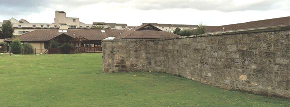
The buildings were demolished in 1974 and a school now occupies the site. All that remains is a portion of the wall that lay between the entrance and main building.

Morayshire former workhouse site from the south-east, 2001.
© Peter Higginbotham.
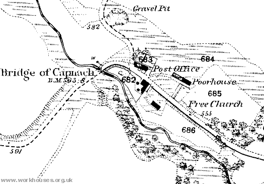
In addition to its participation in the Combination, the parish of Knockando operated had its own poorhouse or almshouse. This establishment was administered by the Parochial Board rather than operating as a statutory poorhouse under the central Board of Supervision. The poorhouse was located at Upper Knockando, just to the east of the Bridge of Capnach. It is identified as a poorhouse on the first edition Ordnance Survey map of 1871, but not on the second edition of 1905.

Knockando poorhouse site, 1871.
Staff
Inmates
Records
Note: many repositories impose a closure period of up to 100 years for records identifying individuals. Before travelling a long distance, always check that the records you want to consult will be available.
- Moray Council Heritage Centre, Old East End School, Institution Road, Elgin IV30 1RP.
Bibliography
- None.
Links
- None.
Acknowledgment
- Thanks to Hilary van den Berg-Cameron for contributing the poorhouse picture. Hilary's grandparents were Matron and Governor of the institution from 1928-1956
Unless otherwise indicated, this page () is copyright Peter Higginbotham. Contents may not be reproduced without permission.


